GIS Data
We will be mapping and analyzing GIS data as the course progresses. There are several standard formats for mapping GIS data:
Here's an
excellent summary & comparison of these formats.
Note for the future: In Lab 9, we will introduce the Folium Python package that creates HTML maps. For the honors section, we will use additional features in folium for creating choropleth maps using geoJSON files.
github

We introduced github, the standard way to share and collaborate on code, in Lab 5. It also has a nice feature for quickly previewing geoJSON files.
If you do not already have a github account, follow the directions in Lab 5 to set one up to use below.
geoJSON
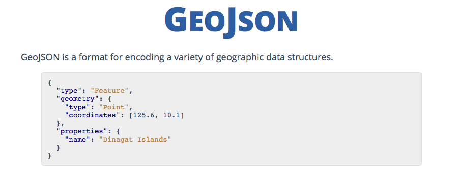
We will be primarily using geoJSON files for this course.
Use the geojson's mapper, locate your neighborhood. Mark your chosen CitiBike stations as points (select from the menu on the right of the map).
- On the right hand side, the corresponding geoJSON file will be created.
- Save the file and upload to github (see above).
- Commit the file and preview.
You should see the a map pop up in the preview window.
(Here's a helpful example.)
Here's a nice description of basic concepts of geoJSON:
- Read/skim the description of different types.
- What types are in the geoJSON file you created above?
- Using the mapper, add a polygon outlining your neighborhood. What was created in the corresponding geoJSON file?
- Also in your file, mark the major transit lines (subway, train, or bus).